Surfaces you'll run into
For riders, "paved" isn't the whole story. What matters is how even and grippy the surface is. These are worth knowing:
| Surface | What it means for you | How to spot it |
|---|---|---|
| Fresh, rough asphalt | consistent grip | dark, uniform surface |
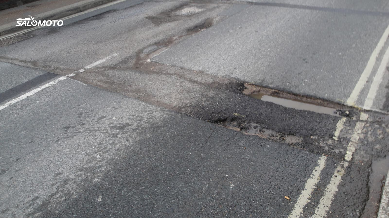
| Patched pavement, tar snakes | changing grip, bumps | color changes, shiny lines |
| Chip seal | loose stone until it settles | light, coarse texture, gravel on edges |
| Grooved pavement, steel grate decks | the bike wanders, slick when wet | construction zones, older bridges |
| Concrete slabs | joints that thump | regular cross joints |
| Gravel or dirt | little grip on street tires | no center line, light-colored track |
How surface fits alongside rhythm, sight lines and width in judging a road is covered in what makes a great motorcycle road. This page is about finding out what the surface is before you get there.
What map data knows about surface
Many planners and apps use OpenStreetMap. There, the "surface" tag records a road's material, such as asphalt, concrete, sett or gravel, and the "smoothness" tag its evenness. Both are optional: there's no default value, and many minor roads simply don't have them. A router built on that data can only avoid roads that are explicitly marked unpaved.
That gives you a simple rule: map data tells you what a road is supposed to be, not what shape it's in today. Potholes, fresh patches and chip seal don't appear on any map. Road class is a useful hint, not proof: US and state highways are usually well maintained, while county roads vary a lot from county to county, and some still turn to gravel without much warning.
Check a road before you ride it
A few minutes on screen pay off before you take on a new road:
- Satellite view: Is the road dark and uniform all the way, or do you see patches, light sections and missing lines?
- Street-level imagery with a date: Ground-level photos show surface and shoulders, but they're often years old. Check the capture date.
- 511 and DOT maps: Most states publish construction, closures and conditions; that's also where resurfacing projects show up.
- Ask locals: Clubs, dealers and forums usually know which road took a beating over winter.
- Think about the season: Spring brings sand and frost heaves in cold states, summer is chip-seal season in many areas, fall brings wet leaves. See planning a ride around weather and season.
- After storms: Heavy rain washes gravel, mud and branches onto the road, especially on slopes and at low spots.
If a section still looks doubtful, plan an alternative or add waypoints so the route follows a road you know.
Read the surface on the road
Even the best prep doesn't replace watching the pavement. Warning signs for rough road, loose gravel, grooved pavement or a pavement end are there for a reason. Beyond the signs, these clues help:
- Color changes in the asphalt mean patches, moisture or sealant.
- Shiny spots in heat or rain mean less grip, as do painted lines and metal covers when wet.
- Dirt and gravel at driveways and on corner exits are classic backroad traps.
- Shaded stretches stay damp longer, and in fall they collect leaves.
Ride any unfamiliar road so you can react to bad pavement at any moment. If you want to work on braking and cornering on tricky surfaces, a rider training course is the place for that, not a public road.
Surface, your bike and what Salomoto can do
How much rough pavement bothers you also depends on your bike and tires. On street tires with a sporty riding position, gravel sections are unpleasant; on an adventure bike they're less of an issue. If you want to mix pavement with legal gravel roads on purpose, see how to plan an adventure bike route, and the Bike Match guide on a motorcycle for pavement and gravel helps with the bike itself.
The Salomoto route planner plans routes for free within Germany only and always avoids roads that its map data marks as unpaved. Because many roads lack that information, a gravel stretch can still slip through. Salomoto does not know current conditions, construction or fresh chip seal. You can download the finished route as a GPX file, and after the ride log it by hand in RoadDex with a free account; RoadDex is a logbook and records no GPS.